
GEODNET GEOD: Decentralized Precision Navigation Network
Table of Contents
Imagine GPS that’s 100x more accurate — pinpointing your exact location within centimeters instead of meters. That’s the mission behind GEODNET GEOD, a pioneering Decentralized Physical Infrastructure Network (DePIN) that blends blockchain incentives with real‑world geospatial technology to build the world’s largest precise positioning system.
At its core, GEODNET deploys a global mesh of Real‑Time Kinematics (RTK) reference stations — known as satellite miners — that collect correction data and broadcast it to nearby devices. In return, contributors earn GEOD tokens, the network’s native utility token used for rewards, data subscriptions, and governance.
This decentralized approach not only improves accuracy for autonomous vehicles, drones, agriculture, and AR/VR applications — it also opens up new monetization models for contributors. In this guide, we’ll break down how GEODNET works, its token utilities, real‑world use cases, and why it’s rapidly becoming a critical layer in Web3’s location infrastructure.
For more insights and updates on the latest cryptocurrency trends, visit our Nifty Finances platform, your gateway to smarter financial decisions in the digital economy.
What Is GEODNET GEOD? A Decentralized Geo‑Data Network
GEODNET (GEOD) is a decentralized geo-data network designed to provide high-precision positioning and geospatial data on a global scale. Built on blockchain principles and leveraging DePIN (Decentralized Physical Infrastructure Networks), GEODNET aims to create a distributed network of satellite reference stations that deliver real-time kinematic (RTK) correction data for centimeter-level accuracy. This infrastructure is particularly valuable for applications in robotics, drones, autonomous vehicles, augmented reality, and other industries requiring precise geolocation.
A Decentralized RTK Positioning Network
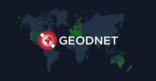
At the heart of GEODNET is its expansive RTK positioning network, powered by individual satellite base stations contributed by participants around the world. Each station forms a node in a decentralized grid, generating correction data that improves positioning accuracy for nearby devices. By decentralizing these reference stations, GEODNET avoids reliance on single providers or centralized infrastructure, creating a resilient network capable of global coverage.
Users and organizations can operate a GEODNET station, contributing real-time geospatial data to the network. In return, operators earn GEOD tokens as incentives, fostering participation and ensuring the continual expansion of network coverage. The platform also employs additional reward mechanisms, such as Location NFTs and SuperHex staking, to encourage optimal station placement and high-quality data contributions.
Real-World Applications
GEODNET’s decentralized infrastructure provides practical utility across multiple sectors. Autonomous systems, including robots and drones, can access RTK-corrected positioning for navigation and operations, while augmented reality devices gain precise alignment with the physical world. The network also supports logistics, surveying, and mapping applications where centimeter-level accuracy is essential.
By providing real-time geospatial data at scale, GEODNET enables developers and enterprises to integrate highly accurate location data into their systems without investing in expensive proprietary infrastructure. This democratizes access to precision geolocation, making advanced navigation and robotics more broadly achievable.
Token Incentives and Network Growth
The GEOD token underpins the economic model of the GEODNET network. Participants who deploy and maintain satellite reference stations earn GEOD rewards, creating a self-sustaining incentive loop. Additionally, 80% of the network’s data revenue is used to buy back and burn GEOD tokens, ensuring long-term token value and encouraging continued participation.
These tokenomics align user incentives with network expansion: more stations and higher-quality data generate greater network utility, which in turn increases GEOD demand. Operators are rewarded not only for running stations but also for ensuring consistent performance and optimal coverage, driving the network toward global real-time geolocation.
A Global Network for the Autonomous Future
GEODNET represents a shift toward decentralized, community-driven geospatial infrastructure. By combining blockchain incentives, DePIN principles, and satellite RTK technology, the network aims to cover the entire Earth with reference stations, providing centimeter-level accuracy for real-world applications.
GEODNET (GEOD) is a decentralized geo-data network that empowers participants to contribute to a global RTK positioning system, supports precision-dependent technologies like robotics and AR, and leverages token incentives to drive network growth and sustainability. Its innovative approach creates a truly decentralized alternative to traditional geospatial infrastructure, enabling real-time, high-accuracy navigation and location services worldwide.
How the GEODNET Network Works (RTK & Blockchain)
The GEODNET network (GEOD) combines cutting-edge geospatial technology with blockchain infrastructure to create a decentralized, high-precision positioning system. By integrating real-time kinematic (RTK) correction data with a tokenized, community-driven framework, GEODNET enables centimeter-level location accuracy for a variety of applications, from autonomous vehicles to precision surveying.
Satellite Miners: Reference Stations at the Core
At the foundation of GEODNET are the reference stations, often called “Satellite Miners.” These nodes receive signals from global navigation satellite systems (GNSS), such as GPS, GLONASS, Galileo, and BeiDou, and generate real-time correction streams.
The corrections account for errors caused by atmospheric conditions, satellite orbit inaccuracies, and multipath interference, transforming ordinary meter-level GPS readings into centimeter-level positioning data. Each Satellite Miner contributes to the network by continuously broadcasting these corrections, ensuring that nearby devices can achieve unprecedented location accuracy.
Decentralized Node Architecture
Unlike centralized RTK networks, GEODNET operates as a decentralized network of nodes. Each station functions independently while sharing correction data across the network. The distributed design provides several key benefits:
- Improved Accuracy: By aggregating correction data from multiple nodes, devices achieve ~1–2 cm precision.
- Redundancy & Reliability: The decentralized setup eliminates single points of failure, ensuring continuous operation even if individual stations go offline.
- Scalability: Community deployment of new nodes expands coverage and improves performance in underserved regions.
This architecture allows the network to scale organically, leveraging community incentives to deploy stations strategically and maximize global coverage.
Blockchain Integration & Data Validation
Blockchain technology is central to GEODNET’s trust model. Each correction stream is validated and timestamped on-chain, providing an immutable record of data quality and availability. Blockchain-based mechanisms ensure that:
- Only accurate and verified data is rewarded
- Transparent rewards are distributed to node operators in GEOD tokens
- The network remains resilient against manipulation, spoofing, or low-quality data
This combination of RTK technology and blockchain validation ensures that every centimeter of correction data is both precise and reliable.
Incentivizing Community Deployment
GEODNET leverages a tokenized incentive model to encourage widespread participation. Operators who deploy Satellite Miners earn GEOD tokens proportional to their station’s contribution, uptime, and coverage. Additional mechanisms, such as staking and token rewards for optimal station placement, help drive strategic expansion of the network.
By aligning economic incentives with network performance, GEODNET ensures that contributors are motivated to maintain high-quality stations and expand coverage where it is most needed.
Real-Time Data for Precision Applications
The real-time correction data provided by GEODNET serves a wide range of applications:
- Autonomous Vehicles: Enable precise navigation and obstacle avoidance
- Drones & Robotics: Supports centimeter-level positioning for deliveries, inspection, and mapping
- Surveying & Mapping: Offers accurate geospatial data without expensive traditional RTK infrastructure
- AR/VR & IoT: Improves alignment of virtual overlays and connected devices with the physical world
This real-time feed ensures that GEODNET is not just a theoretical network but a practical solution for next-generation technologies that demand accuracy and reliability.
The GEODNET network functions as a community-powered, blockchain-verified RTK positioning system, combining Satellite Miner nodes, decentralized correction streams, and tokenized incentives. Its innovative design delivers high-precision geospatial data, scalable coverage, and secure validation, making it a cornerstone for precision applications in a decentralized, real-time world.
Mining & Incentive Mechanisms
The GEODNET (GEOD) network incentivizes the growth of its decentralized RTK positioning system through a carefully designed mining and rewards framework. By rewarding contributors for deploying and maintaining high-quality base stations, GEODNET aligns the interests of participants with the network’s long-term goal of creating a global, high-precision geospatial infrastructure. This system goes beyond traditional cryptocurrency mining by linking token issuance directly to real-world infrastructure contribution and performance.
Earning GEOD Through Base Stations
The primary way participants earn GEOD tokens is by deploying satellite reference stations, known as “Satellite Miners.” Each station collects GNSS signals, generates RTK correction data, and transmits this data to the network. The quality, uptime, and accuracy of these stations directly influence the rewards a contributor receives:
- Performance Metrics: Stations with consistent, high-quality data streams earn more tokens.
- Uptime: Continuous operation without interruptions ensures higher mining efficiency and reward accumulation.
- Coverage Contribution: Stations placed in areas with limited existing coverage are often rewarded with higher multipliers, incentivizing strategic deployment.
This system ensures that the network grows in both scale and reliability, rewarding participants for adding real, usable infrastructure rather than speculative token hoarding.
SuperHex Staking for Enhanced Rewards
GEODNET further incentivizes network participants through the “SuperHex” program, which allows contributors to stake their GEOD tokens in exchange for reward multipliers. By locking tokens into the system, participants demonstrate long-term commitment to network development and gain the opportunity to increase their mining returns.
This staking mechanism serves multiple purposes:
- Encourages Long-Term Participation: Contributors are motivated to remain active in the ecosystem rather than cashing out early.
- Boosts Network Security: Staked GEOD strengthens the overall economic alignment of the network.
- Reward Multipliers: SuperHex participants earn proportionally higher token rewards based on the amount and duration of their stake.
Annual Reward Halving
To maintain token scarcity and long-term economic sustainability, GEODNET implements an annual reward halving schedule. Similar to Bitcoin’s model, the halving reduces the number of new GEOD tokens issued per period, gradually decreasing inflation over time. This mechanism:
- Protects token value by preventing oversupply
- Encourages early adoption while maintaining incentives for continued contribution
- Aligns miner rewards with network maturity and scaling
By combining reward halving with performance-based incentives, GEODNET balances short-term participation with long-term infrastructure growth.
Emphasis on Sustainable Contribution
GEODNET’s incentive structure emphasizes real-world infrastructure over speculation. Unlike purely financial mining schemes, token issuance is tied to the creation of usable geospatial data. Contributors are encouraged to:
- Maintain stations over the long term
- Optimize placement for global coverage
- Ensure data quality and reliability for end-users
This alignment between token rewards and network utility ensures that GEODNET develops into a robust, decentralized geospatial infrastructure, rather than a speculative network detached from tangible outcomes.
GEODNET’s mining and incentive mechanisms are designed to foster sustainable growth, high-quality data contributions, and network resilience. Contributors earn GEOD tokens by deploying and maintaining base stations, participating in SuperHex staking for higher multipliers, and strategically supporting network coverage. Combined with annual reward halvings and a focus on long-term infrastructure, these mechanisms create a self-reinforcing ecosystem that promotes the expansion of a global, decentralized, high-precision geospatial network.
Real‑World Applications of GEODNET
GEODNET (GEOD) is a decentralized geo-data network that delivers centimeter-level positioning and real-time geospatial data. By combining satellite reference stations, RTK correction streams, and blockchain-based incentives, the network supports a wide range of precision applications across industries. Its decentralized infrastructure and high-accuracy positioning capabilities make GEODNET an essential tool for emerging technologies that rely on precise location data.
Autonomous Vehicles and Robotics
One of the most immediate and transformative applications of GEODNET is in autonomous navigation. Self-driving cars, delivery drones, and industrial robots require centimeter-level positioning to operate safely and efficiently. GEODNET provides real-time correction data, enabling vehicles to:
- Navigate complex environments with minimal error
- Avoid collisions and optimize routes
- Operate reliably in areas where standard GPS would be insufficient
Robotics applications, from warehouse automation to outdoor drones, also benefit from GEODNET’s high-frequency, low-latency correction streams, ensuring precise control and operational efficiency in real-world environments.
Agriculture and Construction
Precision agriculture and construction rely on accurate geolocation for equipment guidance. GEODNET supports:
- Smart tractors and harvesters with centimeter-level field positioning
- Construction machinery for grading, excavation, and material placement
- Automated irrigation systems that require precise location tracking
By providing affordable and decentralized RTK data, GEODNET reduces the need for costly proprietary infrastructure, enabling farms and construction projects to increase efficiency, reduce waste, and enhance productivity.
Earthquake and Geohazard Monitoring
GEODNET’s network of satellite reference stations can also support geohazard monitoring. High-resolution positioning data allows for the detection of small ground movements, which is critical for:
- Earthquake early-warning systems
- Landslide and flood monitoring
- Infrastructure stability tracking
Real-time geospatial data from GEODNET enhances the timeliness and accuracy of hazard detection, providing governments and agencies with actionable information for disaster prevention and response.
AR/VR and Metaverse Digital Twins
Augmented reality (AR), virtual reality (VR), and digital twin applications require precise spatial alignment to overlay digital content onto the physical world accurately. GEODNET enables:
- Accurate positioning for AR navigation apps
- Digital twin mapping for smart city planning
- Immersive VR experiences anchored to real-world locations
This infrastructure supports developers building location-aware metaverse experiences, bridging the gap between digital simulations and physical spaces.
Smart City and IoT Solutions
Finally, GEODNET contributes to the development of smart cities and IoT ecosystems. Applications include:
- Sensor networks that monitor traffic, utilities, or environmental conditions
- Real-time geolocation of assets and public services
- Enhanced mapping and navigation for urban planning and infrastructure management
By providing decentralized, real-time geospatial data, GEODNET enables cities and enterprises to deploy intelligent, location-aware systems without relying solely on centralized infrastructure.
GEODNET’s decentralized RTK network delivers high-precision, real-time geospatial data that powers a wide array of real-world applications. From autonomous vehicles and robotics to agriculture, construction, hazard monitoring, AR/VR experiences, and smart city solutions, the network is enabling next-generation technologies that require accurate, reliable, and scalable positioning data. Through its token-incentivized, community-driven infrastructure, GEODNET is shaping the future of precision navigation and location intelligence worldwide.
GEODNET GEOD is redefining how geospatial and positioning data is generated, distributed, and monetized in the Web3 era. By combining decentralized satellite Base Stations with blockchain incentives, it elevates traditional GPS accuracy to a centimeter‑level precision suitable for autonomous vehicles, industrial automation, robotics, and digital‑physical applications that depend on real‑time, precise location services.
The GEOD token plays a pivotal role as both a reward mechanism and utility token for accessing data services, while multi‑chain support broadens accessibility and liquidity. Mining incentives like SuperHex staking and performance‑based rewards ensure that contributors are aligned with the network’s growth goals, and real‑usage‑driven buy‑backs and burns enhance token sustainability.
What if every trip you made with your GPS paid you in crypto? Say hello to MapMetrics, the world’s first Web3 drive-to-earn navigation app powered by the MMAPS token. Built for drivers, cyclists, and even pedestrians, MapMetrics flips the script by rewarding users for contributing real-time traffic data—all while maintaining complete anonymity.
MapMetrics is a decentralized, blockchain-powered navigation platform that redefines how users interact with GPS technology. Unlike traditional apps such as Google Maps or Waze, which monetize user data without direct benefit to the user, MapMetrics offers a Web3 navigation experience where users retain control over their data and earn rewards in real time.
Whether you’re exploring DePIN innovation, precision navigation networks, or blockchain utility beyond finance, GEODNET presents a compelling infrastructure project with real‑world impact and long‑term scalability.
[…] data for profit, MapMetrics lets you keep control. With blockchain-backed privacy, a custom SNT (Special Navigation Token) device, and seamless crypto rewards, it transforms your daily commute into a passive income […]